
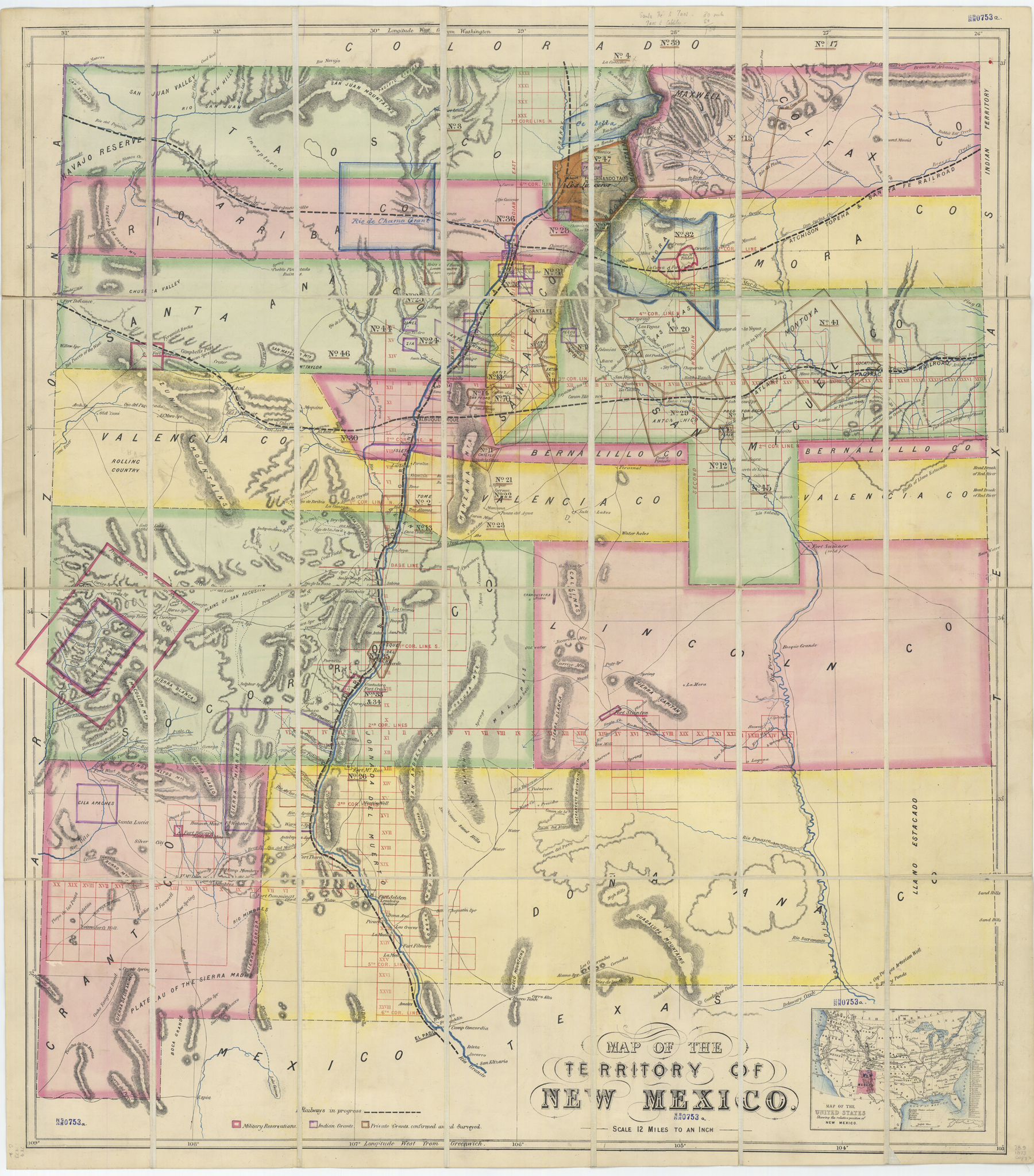
Title: 1873 Map of the Territory of New Mexico
While New Mexico’s external boundaries were relatively established by the 1870s, the counties and their borders were still subject to adjustments. This colorful map displays counties and land-grant boundaries. To put New Mexico’s geographical size and location in proportion, the English publisher added an inset map of the United States.
Paper, London: Witherby and Co., 1873. Fray Angélico Chávez History Library NMHM, Map Collection 78.9 1873.
Credit:
Copyright: © This image must include credit line and copyright statement.
Tags: